But first we had about 1½ miles to go, negotiating the last lift bridge and filling up with water on the way. After another frosty start the well-established pattern of a bright start turning into a misty day was repeated, but it wasn’t really foggy, just a bit gloomy.
These Longhorn Cattle were grazing in the field near Whitehouse Bridge.

Originating in Craven on the Yorkshire/Lancashire boundary, the horns can rise over the head or fall and frame the face. The one in the picture couldn’t make her mind up, so opted for one of each…
Past Irish Bridge the canal runs along the edge of the valley, contained in a concrete edged channel. Every so often there are narrow sections designed to accommodate stop-planks to be used for maintenance or in the event of a breach. They also act as chicanes for boats, so you need to look out for them…
About a mile downstream of Pontcysyllte Aqueduct is the railway viaduct carrying the Shrewsbury to Chester line. At 147 feet high the Newbridge or Cefn Bychan Viaduct is a little higher than the aqueduct, and was finished in 1848. It can be glimpsed through the trees on the valley side of the canal.

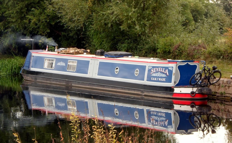
Permanent moorings at the Froncysyllte limekilns and wharf constrict the channel somewhat, making it interesting for inexperienced crews to pass oncoming boats.

Fron footbridge and lift bridge

After dealing with the lift bridge there’s a right bend, the canal now heading directly towards the valley crossing. We filled with water at the end of the permanent moorings along here, then headed off again, to the main event.
The aqueduct comes into view, good, there’s no-one coming the other way.

The channel is only wide enough for one narrowboat.
Launching into space, or at least that’s what it feels like…

It’s possible to make good progress over this one. The towpath is cantilevered out over the channel, allowing the 18 tons of water we displace to run back behind us as we move forward.
Looking west

That’s the Dee down there.

At the northern end, looking back.

Some stats for you…
The iron trough is 136 yards long, 12 feet wide (including the bit under the towpath) and 5¼ feet deep. It sits on 18 hollow masonry pillars, the spans being 53 feet wide. It took 10 years to build, opening in 1805. Users of the towpath are protected by the iron railing seen above, and provision, in the form of holes, was made in the flange on the offside, although never used. Standing on the counter of a crossing narrowboat there’s nothing to prevent you stepping off into 126 feet of fresh air…
Leaving the aqueduct Trevor Basin is straight on, at the end of the arm almost filled with hire boats, now laid-up during the off-season.

The route to Llangollen is under that bridge on the left.
Heading west again after the awkward turn the canal is once again concrete-edged, uninspiring but the scenery gets better and better.

At the end of the first tree-lined section the channel becomes very shallow for a few hundred yards, and there’s a new sign recommending single file traffic here. But generally it’s got fair depth, if a bit narrow in places.


Looking out over the Dee valley.

Castel Dinas Bran. Llangollen is the other side of that hill.

We pulled in at Bridge 41W, opposite the Sun Trevor Hotel. The towpath is that fine, grey gravel which gets everywhere in wet weather, but there’s good satellite TV reception here. Terrestrial reception is almost non-existent along here.
Just read that Les Biggs has passed away today, after a long battle with cancer. The world is a worse place with then passing of this lovely man. Our thoughts are with Jaq.
Locks 0, miles 4
No comments:
Post a Comment