We finished up with 5 boats on the pontoons by the evening, but three had set off by mid-morning, catching the flood tide to run upstream to Cromwell Lock.
Almost empty again


The viaduct, now disused, connected an oil terminal on the east bank to Retford to the west.
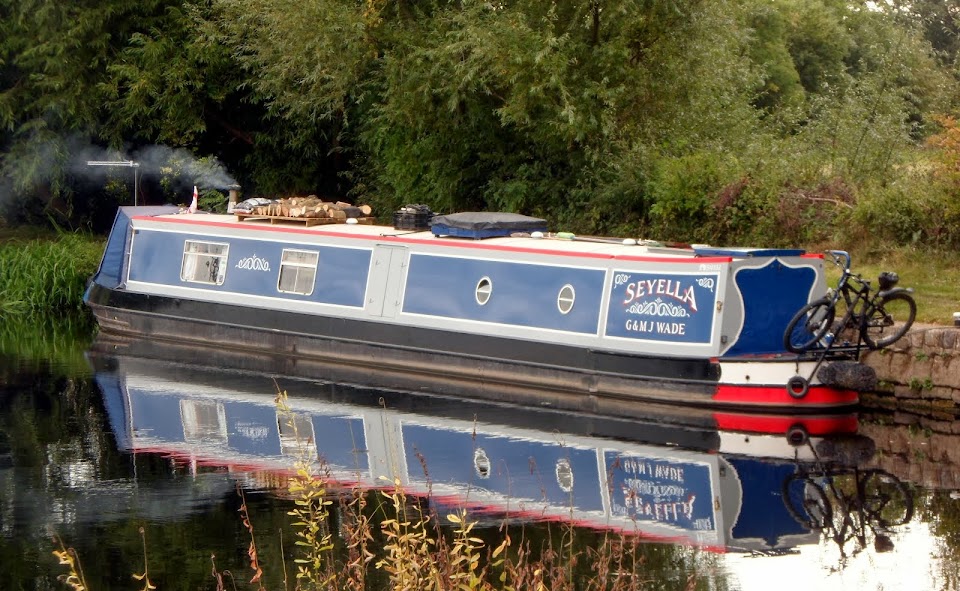
There were a few other boats out and about, this is Whistle Down the Wind, with West Burton Power Station in the background.
 Spotted the tall chimney on the boat? It’s steam powered!
The river is pretty remote, just a few settlements sit on the banks. Littleborough was a Roman settlement, built to protect a ford across the river. The ford carried the road, called locally the Highdyke, from Doncaster to Lincoln, connecting there to Ermine Street.
Roman ford at Littleborough – west…

…and East

Apparently the ford was of square heavy paving stones, making a raised causeway 18 feet wide and held in place by oak stakes. It still existed up until around 1820 when it was removed to improve the navigable depth of the river.
After the ford causeway was removed the crossing was made by ferry, now also discontinued.
Knaith is another small hamlet, this time on the east side.
Folly on Knaith Hill

We’d left Torksey while the tide was still coming up-river, in order to get to Keadby while there was still enough water to get in over the lock cill. But it was here at Knaith that high water was reached, and our average speed started to increase. From around 3.7 mph for the first 70 minutes, it steadily rose, getting up to a dizzying 8.4 mph near East and West Butterwick. (We are talking narrowboats here).
Finally we passed West Burton Power Station, after watching it gradually approach through the twists and turns of the river.

Gainsborough is the only large town on the tidal river, which runs alongside to the east of the centre.
Unfortunately that means that the waterfront is high piling, but there is a floating pontoon mooring available.
NB Poppy, our travelling companions for today, coming under Gainsborough Bridge

Mooring pontoon, Ok but not our cup of tea.

Nor anyone else’s, I reckon. We’ve not seen anyone moored here on any of our trips.
It had taken us 2¼ hours to get this far, 10 miles from Torksey. The remaining 17 will take us the same time with the ebbing tide giving us a shove from behind…
After Gainsborough the river gets wider, passing West Stockwith at roughly half-way. The lock here takes you up off the river onto the Chesterfield Canal.
West Stockwith Lock

I’d not noticed these before…

…a pair of griffins on the gables of this house at East Stockwith.
The river meanders on, but there are occasional riverside villages to relieve the boredom.
The Crooked Billet in Owston Ferry, but no access from the water.

A lot of water this far down.

Approaching the M180 bridge, about half an hour from Keadby.

The protocol is to give the lock-keeper a shout when you pass the bridge, so he can get the lock ready.
 Keadby Bridge is the last we had to negotiate on the river, and the most unusual.
 Carrying both road and rail, it was designed to lift to allow passage of the large vessels that used to work further upriver. Only the right-hand span was moveable, the large tank on the extreme right being filled with water till it counterbalanced the weight of the span and raised it.

There are several old pictures here showing the bridge in operation.
There are often coastal vessels tied up at the wharfs at Gunness, on the east side, but they were empty today.
Just a half-mile past the bridge is Keadby Lock, our way up onto the Stainforth and Keadby Canal.
Keadby Lock, hiding in the pilings but the giveaway is the control tower, left of centre.

I started turning just beyond the lock, beating back against the flow to turn in. I’ve done it before with no trouble, but this time I got it a bit wrong, just glancing off the upstream wash-wall on the way in. Michael, following on Poppy, came in cleanly…
In Keadby Lock

That’s it, up off the river and onto the Stainforth and Keadby Canal

The lockie had to swing the road bridge for us, then we were on the canal and mooring just a couple of hundred yards on.
You know that “glancing blow” on the wash wall? Well, it was more of a glare than a glance…

Hard enough to break a shackle on the bow fender! Oops!
Soon fixed, though.
Not sure what we’re doing tomorrow, but we’ll probably head to Thorne.
Locks 1, miles 27.
1 comment:
We stayed overnight on the pontoons at Gainsborough, but that was enough. It enabled us to hit the tide just right at West Stockwith for filming the entrance to the Chesterfield Canal for the next of our DVDs.
The tide came in very quickly while we were moored overnight and I reckon that was the fastest that Narrowboat Waterway Routes has ever moved through the water, even though we weren't moving over the ground.
We are leaving Sheffield tomorrow (Friday) but Doncaster Lock is still shut after a pollution incident and the EA didn't have any estimate for opening when I phoned this afternoon. I'm still hoping we will pass you somewhere on Saturday if we get through Doncaster.
Post a Comment